Paragliding
Know before you drive to launch
Flyable or not — with a reason. Soaring windows, site intel, and pilot reviews on every takeoff. Same map as where you park the van.
What's on every takeoff card
The briefing you wish someone gave you
Everything you check before you pack the wing — built by pilots, for pilots.
Head
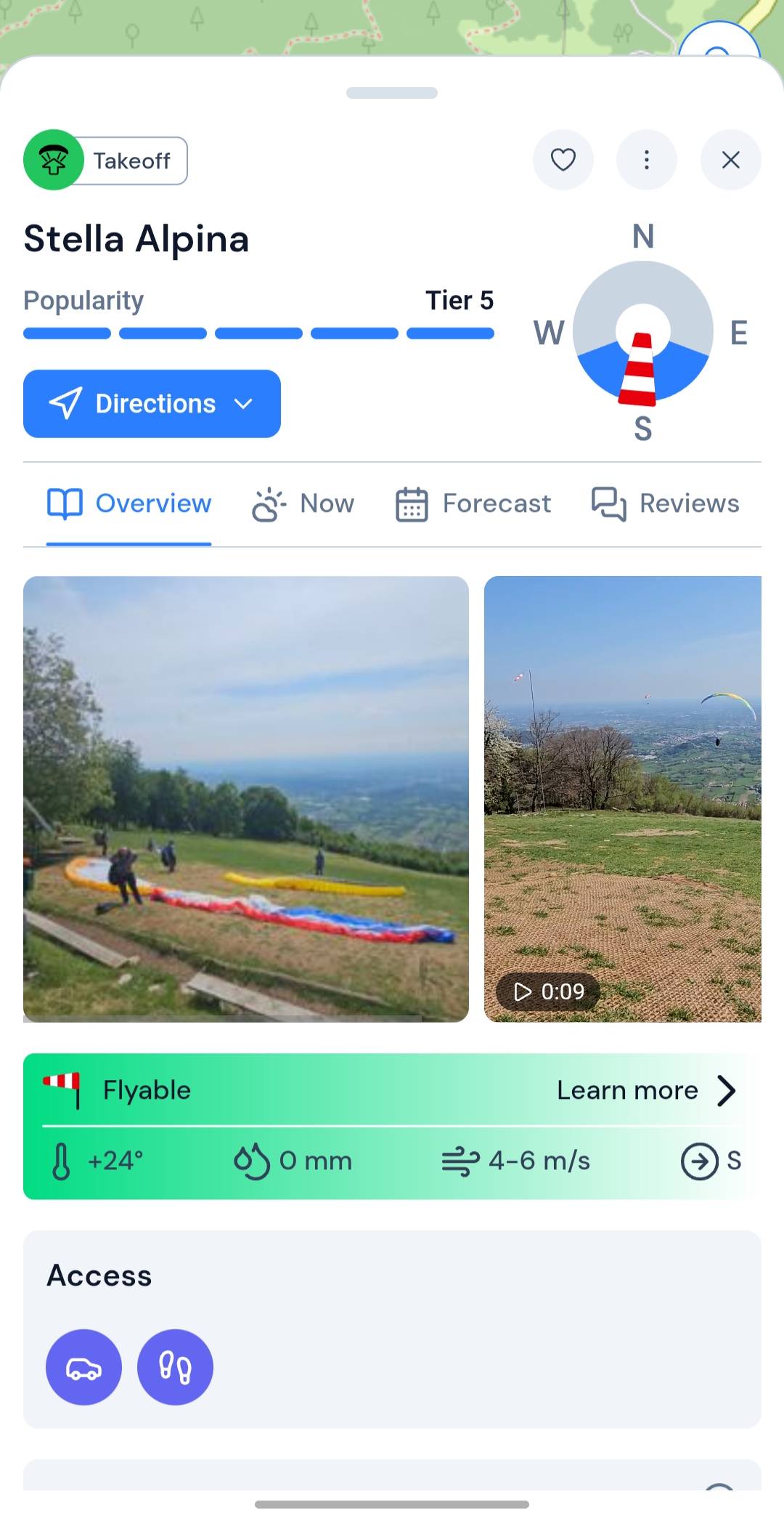
Head of every card — main information at a glance
- Takeoff or landing badge — you know what the pin marks before you read on
- Site name up front — the place you tapped is the place on the card
- Tier 1–5 popularity — see how busy the site gets before you show up
- Flyable directions, with current wind overlaid — in sector or out at a glance
- Favourite sites — save the places with one tap
- Edit info — update details when you've got local knowledge
- Directions — one tap into your preferred navigation app
Overview
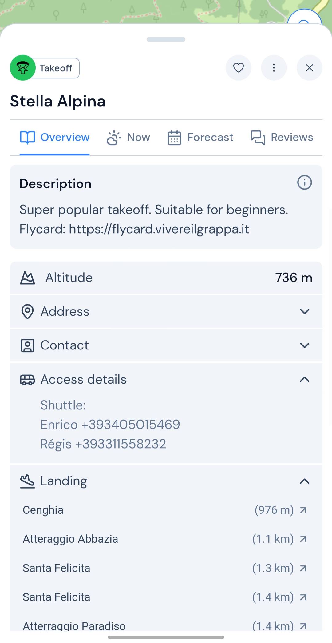
Overview — flyability, site guide, and stats in one scroll
- Photos & video — upload yours and browse pictures and clips from the spot
- Flyability banner — flyable or not, with why, plus current temp, rain, wind strength, and direction
- Access type — car, taxi, cable car, bus, or other
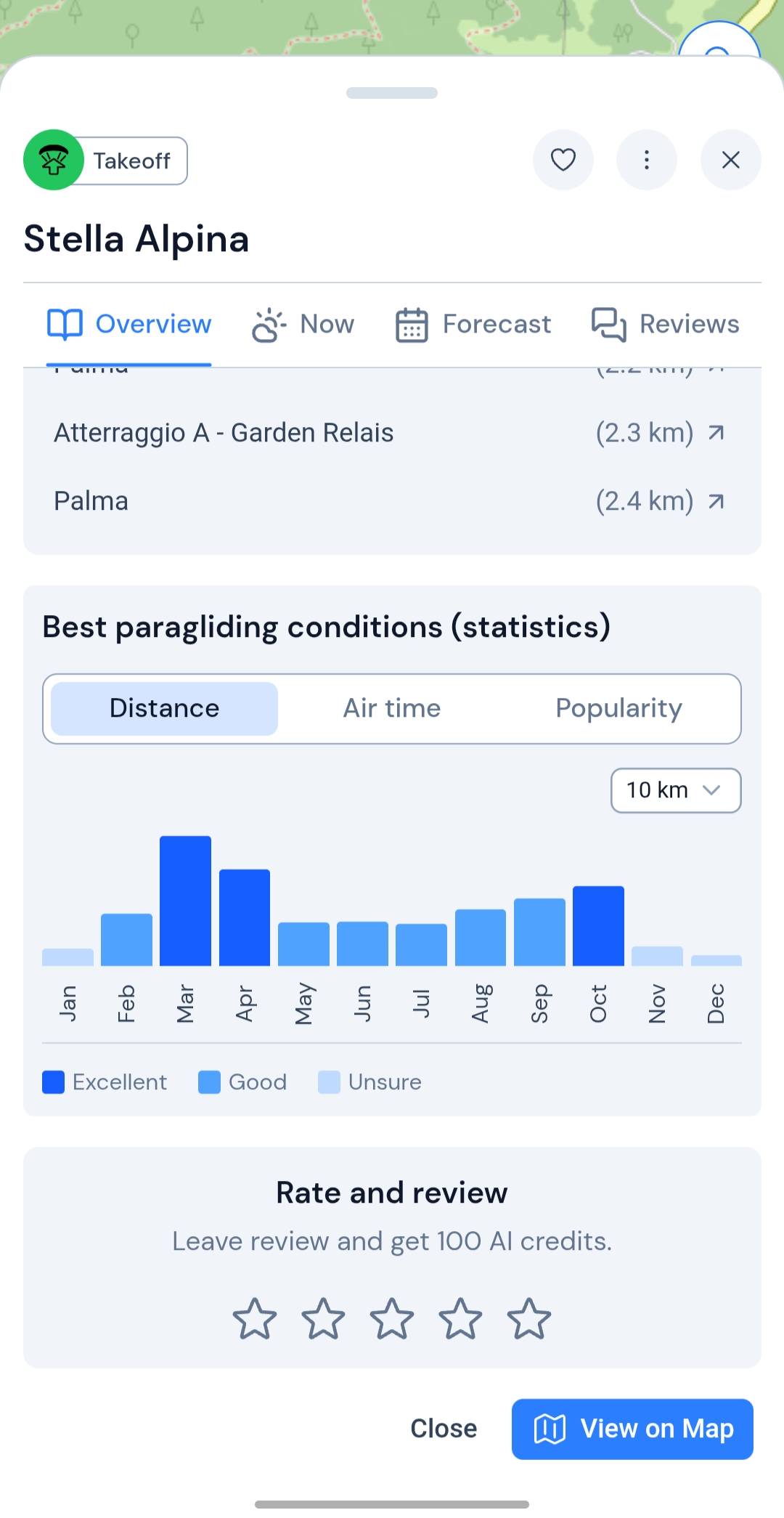
- Description — what the site is like on the ground
- Site details — altitude, address, contact, access notes, and landing
- Best conditions — statistics on when this place flies best
- Rate & review — score the spot and read what other pilots said
Now
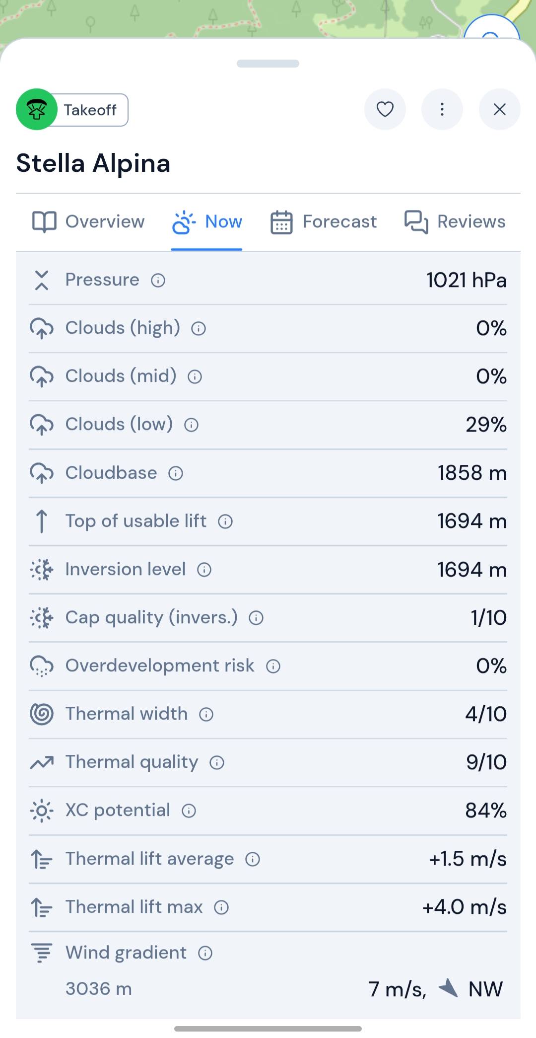
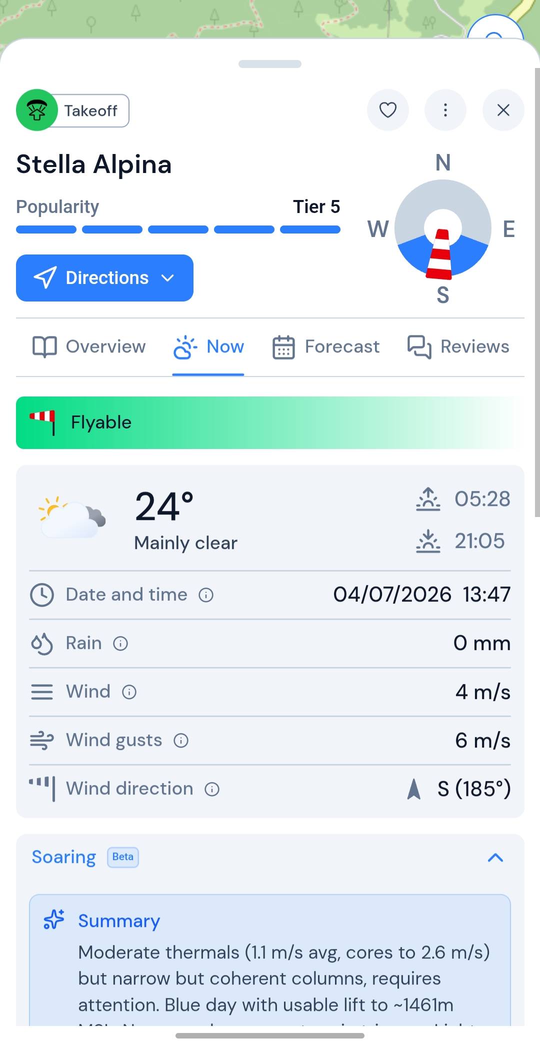
Now — live weather and a soaring brief for this moment
- Live weather — temperature, conditions, sunrise and sunset, rain, wind, gusts, and direction with date and time
- Soaring summary — plain-language read on thermals, lift ceiling, soar window, and strongest hour
- Clouds — pressure, cloud layers, cloudbase, usable lift, inversion level, and overdevelopment risk
- Thermals — width, quality, XC potential, and average and max lift rates
- Wind gradient — wind speed and direction at altitude levels
Forecast
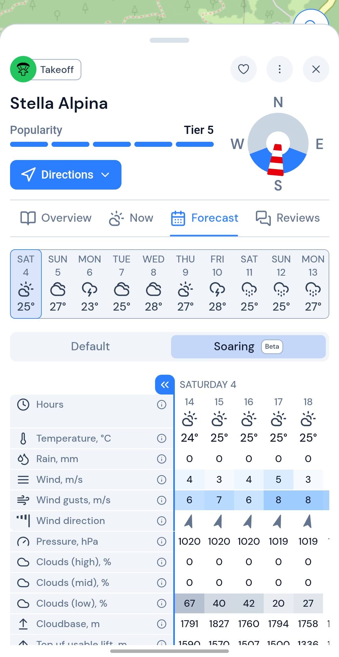
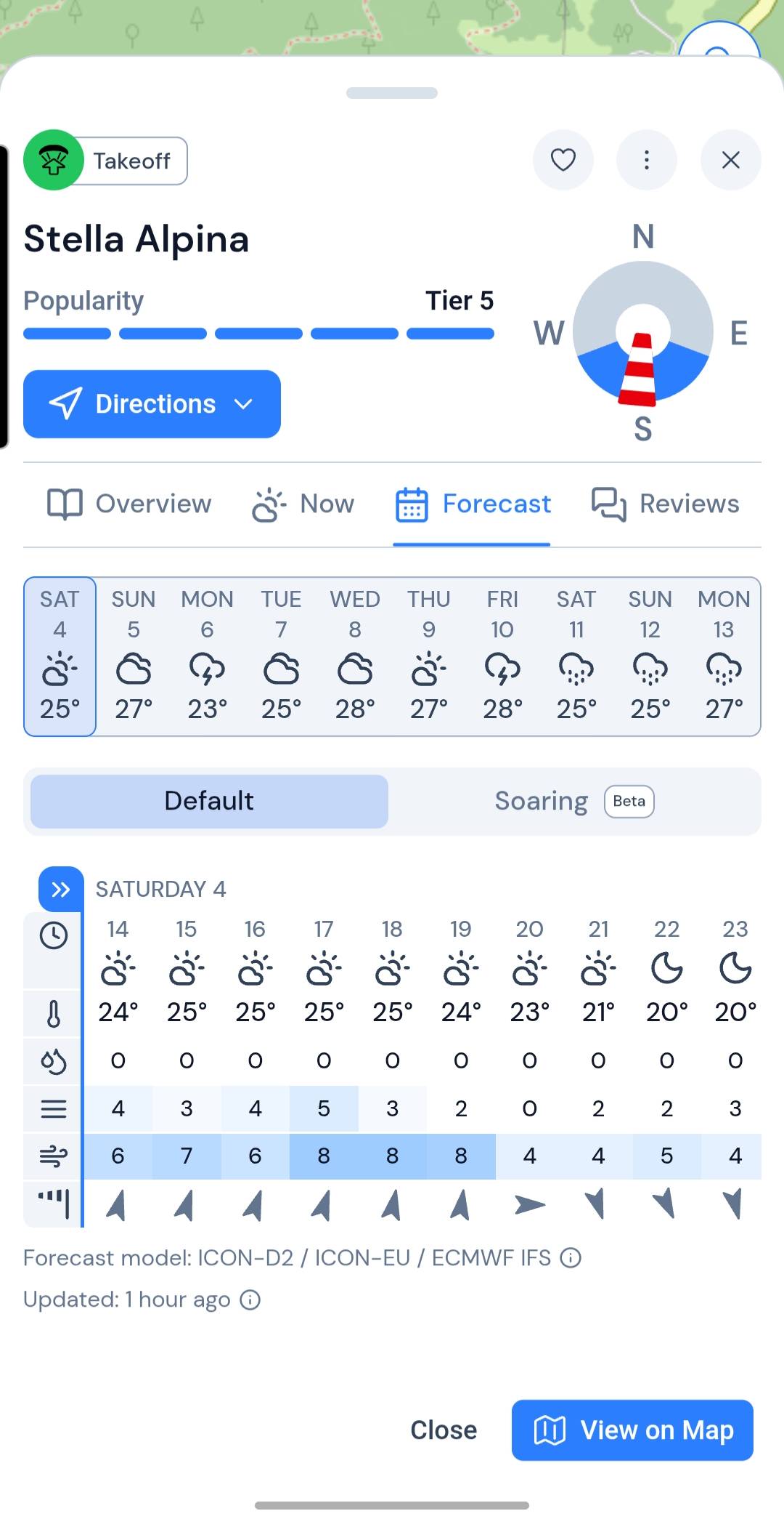
Forecast — ten days ahead, hour by hour
- 10-day forecast — daily outlook to spot when to go
- Default & Soaring — switch between standard weather and paragliding-specific rows
- Default hourly — temperature, rain, wind, gusts, and direction for every hour
- Soaring hourly — pressure, clouds, cloudbase, usable lift, inversion, thermals, XC potential, and wind gradient
Reviews
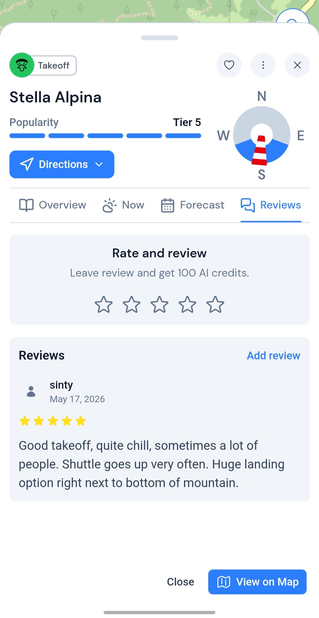
Reviews — star ratings and pilot write-ups from the site
- Overall rating — average stars and how many pilots have reviewed
- Written reviews — honest notes from people who've actually flown here
- Leave yours — rate the spot and tell the next pilot what to expect
Coming soon
Restricted and controlled airspace on the same map as your takeoff — shipping soon.
Airspaces
Airspaces — restricted and controlled zones on the same map
- Restricted areas — no-fly and limited zones near your takeoff and landing
- Controlled airspace — see what's overhead before you launch
- Same map — airspace layers alongside takeoffs, landings, and your route
- On the card — beside flyability and forecast when it ships
Your next fly day starts in the app
Open a takeoff, read the sky, find parking nearby — free map, full paragliding layer included.